
Dec 28, 2021
Snow and Bitter Cold on Tap Tuesday-Wednesday in Central Minnesota
By Jo McMullen / KVSC reporter
The third storm of the holiday season is already producing snow and continue into late afternoon.
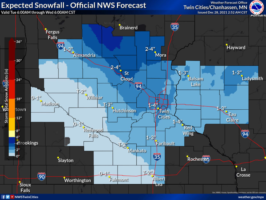
St. Cloud State University retired meteorology professor Bob Weisman is expecting St. Cloud and Little Falls to have the potential for between 1 and 3 inches of new snow by tomorrow.
Weisman adds this system will have the potential to produce between 2 and 4 inches of new snow in much of eastern Minnesota with between 4 and 6 inches possible along the North Shore of Lake Superior.
After the storm winds down, northwest winds will usher in even colder air. Wind chills could drop below -20 in much of central Minnesota with -25 to -30 possible in northwestern, west central, and north central Minnesota tonight into Wednesday morning.
The wind chills are serious enough to cover exposed skin and pack that cold weather survival kit in your vehicle for travel tonight and beyond. Also to note, St. Cloud has the potential to reach the 10 snowiest Decembers by year’s end, but still rank within the 10 warmest years.